Flying in the ocean of air.
We fly in an ocean of air, there are invisible currents, reefs and breaks. On top of it – the water is not clear sometimes.
Skydiving is very similar to aviation, and aviation pays a lot of attention to weather. Airplanes have engines – skydivers don’t, so we must pay even more attention to weather, since we have only one take for landing.
There are few weather related accidents in the freefall, and lots of accidents after canopy deployment, so we can concentrate on canopy flying weather, and we take a lot from paragliding – these guys are using weather for their advantage.
What are we interested in?
We want to know as much as we can about everything that can:
- Change flight characteristics of our canopy – most dangerous – on landing.
- Prevents us from returning to our landing area
- Hurt us
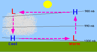
Frontal Winds
Air mass, moving in a predictable direction: This forecast can be trusted – big air mass doesn’t just stop and goes away. You can see it on most weather channels for a long term forecast
This forecast doesn’t give you an idea of what is the day of skydiving would be, but it is important to know to predict weather changes. Also it is a fun to watch
High pressure area is an area of good weather – light winds, no clouds.
Low pressure is bad weather – it sucks in moisture, creates clouds etc.
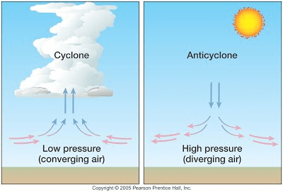
The most dangerous place is the edge between high and low pressure areas: when the weather is changing.
- When weather is getting worse – all clouds will be pushed in from high pressure area.
- When weather is improving – high pressure area is pushing low pressure area away. It is usually associated with strong winds: very much ike like blowing dirt away.
Best days to skydive – 1-2 days after improved weather(winds are settled), and 1-2 days before weather getting worse(clouds are not yet covering entire sky).
Why knowing the wind is important
Wind changes canopy range
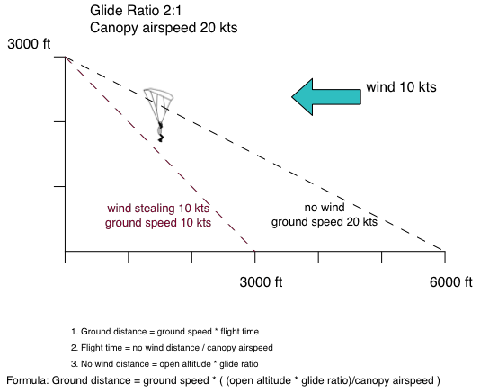
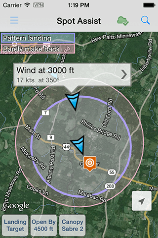
More about canopy flying in a moving air mass, called wind can be found in an article Flying formula from SpotAssist app website
Depending on wind direction we can get very different canopy range, so our exit area have to be planned based on current winds
Wind creates turbulence around obstacles
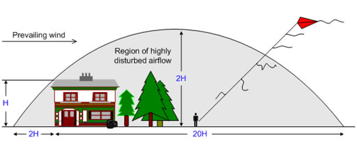
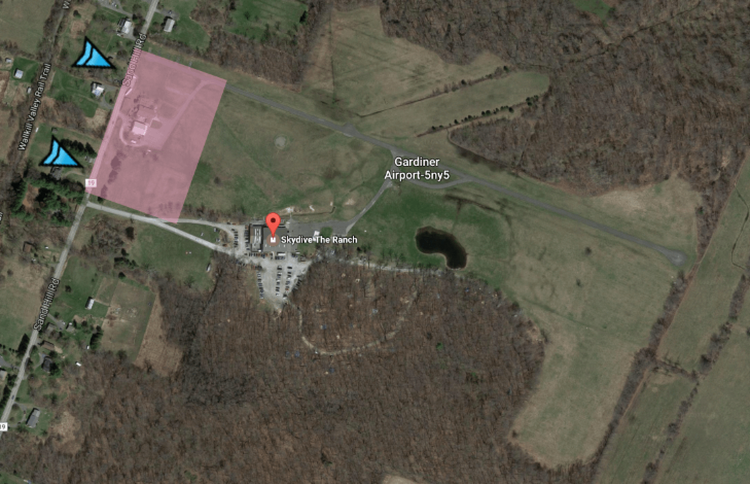
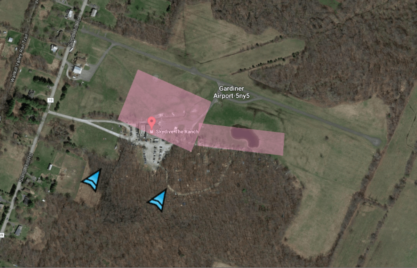
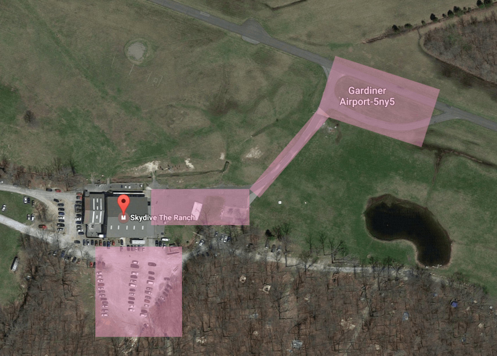
When it comes to the Ranch – we have a narrow field
Local thermal activity
Local thermal activity depends on temperature, season, time of the day: morning or evening. Thermal activity is hard to forecast – it can change hourly.
Thermals
- Spring – caused by very big day/night temperature difference. Wet ground. Both create a lot of thermal activity.
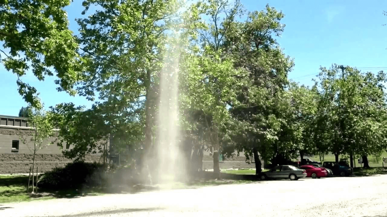
- Summer – Hot days: same reason, but thermals are usually at a very hot day, mostly at mid day. Sometimes we get dust devils. We actually mostly see dust devils in Arizona, since it is a lot of dust there. But we get them at the Ranch too – watch our parking lot. We don’t see dust devils on a landing area, but beware – if you see dust devils on a parking – they are on a landing area as well. They can easily collapse the canopy, very close to the ground.

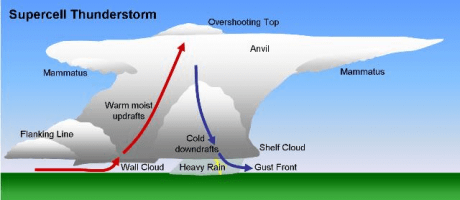
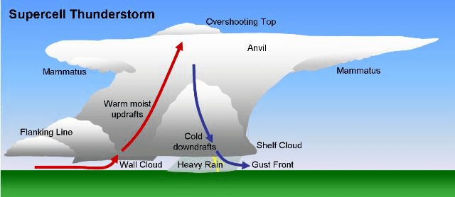
- Thunderstorms around – falling water creates air downdraft, air hits the ground and washes away – sometimes gusty winds reach 20 miles radius.
Danger areas around dropzone – Tarmac, runway – these are overheated areas. They create a lot of updraft. Updraft itself is not a bad thing: the canopy just goes up and struggle with turbulence. The most danger is when the canopy leaves the updraft. Canopy will sink, sometimes a lot. If this happens close to the ground – it might not pick up enough speed for good flare.
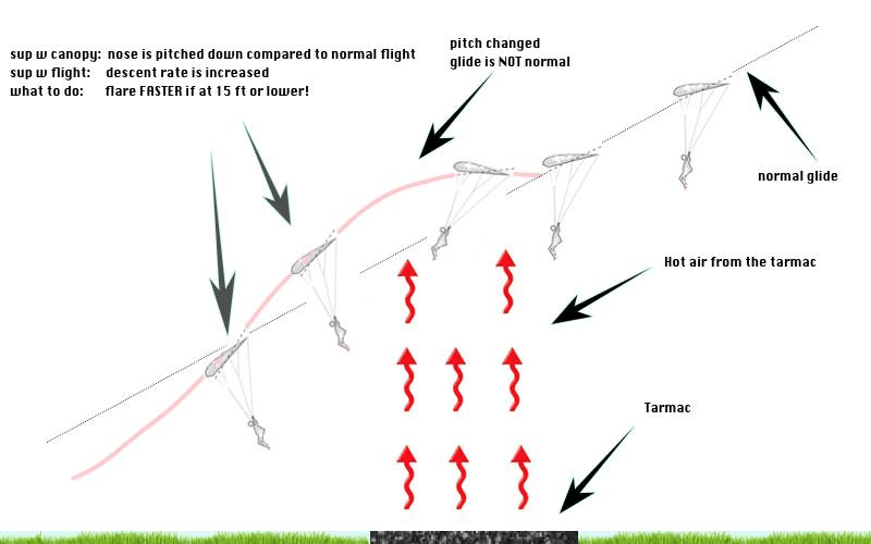
Read a great article about it Surviving the Triangle of DOOM
Clouds
Different clouds provide different visibility.
Usually we are interested in cloud sky coverage: Few (1/8 – 2/8), Scattered(3/8 – 4/8), Broken(5/8 – 7/8), Overcast(8/8). Why do we care?
- Because we might not see our spot from the aircraft
- Because we might not see our landing area after open
- Because if we open in the cloud we might not see traffic.
Where do we get the weather?
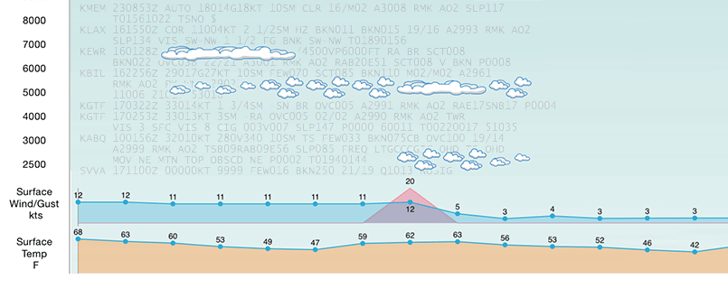
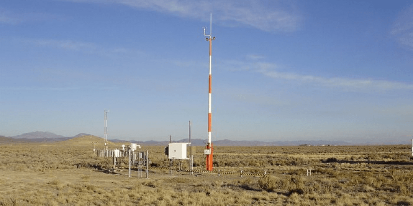
Upper winds are measured by air sondes, they produce winds aloft report. Read more about winds aloft
There are weather stations, that measure current local weather automatically. They are mostly installed at the airports. They produce METAR reports. Read more about METAR
Bigger airports also have forecasters – people who analyze data, and produce Terminal Aeroport Forecast – TAF. Read more about TAF
How do we read weather data?
There are big names, like weather.com, accuweather.com etc. They will show you a lot of information: humidity, sunset/sunrise, Temperature RealFeel etc.
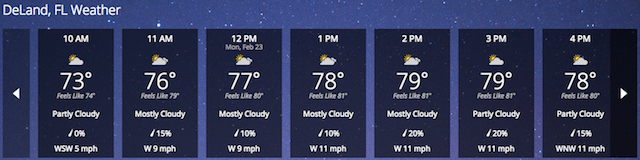
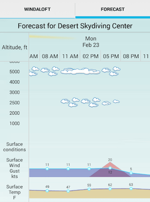
But what skydiver really wants to know is a combination of very few parameters: wind speed with gusts, wind direction, temperature, and clouds coverage. There is a great resource for that:www.usairnet.com. All aviation and skydiving related data at your fingertips:
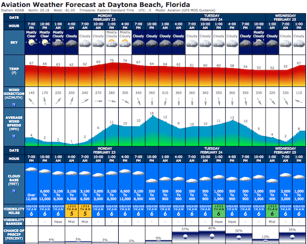
Though, some crucial information is missing. For instance, wind gusts. It is not uncommon to have a 5 knot wind all day, and 20 knot gusts. Strong wind gusts make jumping unsafe.
Although, it is good to know the cloud base, but all clouds are different. For instance, few clouds at 2000 feet is not a problem at all. Also broken clouds at 6000 feet make a beautiful sky, and are safe, as long as you can see the ground.
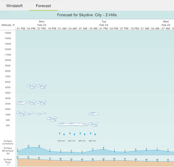
So, it would be very useful to know clouds types, and their exact altitudes.

[di
Read more about Weather Forecast on the SpotAssist website
Good luck with flying in the ocean of air, say safe and Blue Skies


Get Training
-
 C-License Exam Trainer
$4.99
C-License Exam Trainer
$4.99
-
 B-License Exam Trainer
$4.99
B-License Exam Trainer
$4.99
-
 A-License Exam Trainer
$4.99
A-License Exam Trainer
$4.99
Learn

Skydiving Malfunctions
225FREE
Read Articles
Pattern Simulator
May 02,2020 / Simulators Tools / 0 CommentsWind makes landing pattern narrow - the stronger wind - the shorter your base leg will...
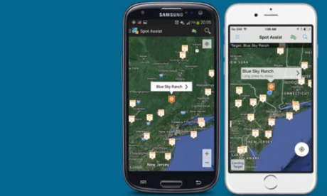
Spot Assist Mobile App
Spot Assist is a mobile application to visualize different stages of your jump Check the...
Freefall Simulator
The faster falling freeflyer drifts with the wind at the same horizontal speed as the slow...
0 responses on "Skydiving Weather"